The race course
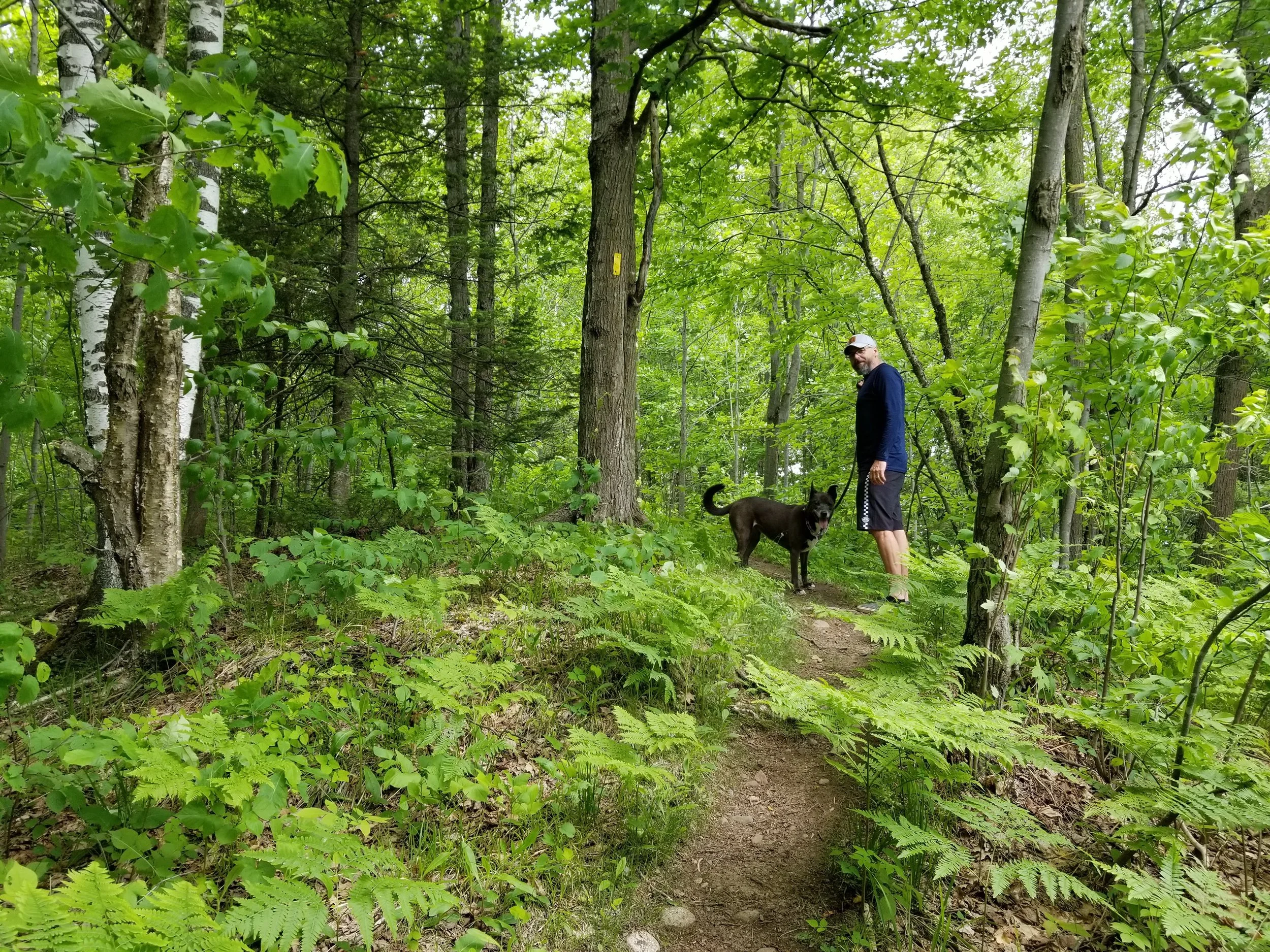
The race is held in Chequamegon-Nicolet National Forest. The majority of the course is on Midwest iconic Ice Age Trail. This is a 1,000 mile footpath contained entirely within the state of Wisconsin. This trail is highly supported by the Ice Age Trail Alliance. We suggest heading over to their website to learn more.
The trail is one of only 11 National Scenic Trails in the country. Ancient glaciers carved the path through rocky terrain, open prairies, and peaceful forests.
The Race Course
It is not going to measure short for you. We see people come in at 100 miles to 106 miles on their watch. Come to this race knowing it varies by watches and plan for this in pacing between aid stations.
Aid station information on link

Race elevation:
100 mile- approximately 6700 feet
100k= approximately 4300 feet
Due to the remoteness of this race course, we are requiring you to download the gpx file as a safety measure to help you get back on course if you were to take a wrong turn. Be sure to know how to use this before arriving on race day.
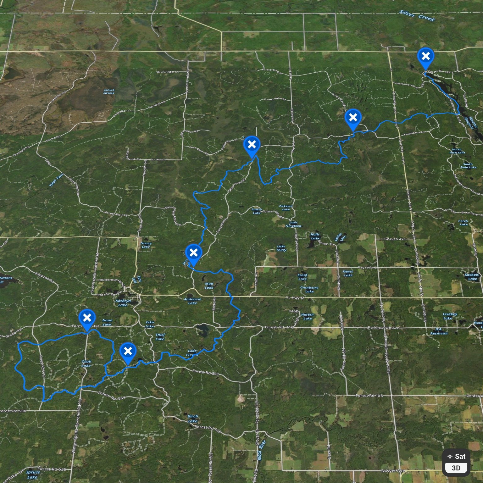
Open visual maps by clicking on the map number below.
Let your crew know they need to download map to work offline. There will not be cell service during the race.
Select your own map
On your Android phone or tablet, open the Google Maps app .
Tap your profile picture or initial. Offline maps.
Tap Select your own map.
Adjust the map according to the area you want to download.
Tap Download.
MAP 1
In this section the runners will be starting the race at the Mondeaux Dam Lodge heading West to jump on the IAT.
The IAT then goes South past the West Point Campground, then the Picnic Point Campground
From here they go West across Route 106 (Campers Rd) and hook up to Rt 102 (Mondeaux Ave). They will be on the road for a short section then enter back into the woods following the IAT
The Trail leads back up to Rt 102 and crosses a bridge then enters back onto the IAT at the parking area. Location of Aid # 1
Aid Station will be located at the following
Aid #1 GPS coordinates 45.292976, -90.499651 Location is the IAT at the Mondeaux Parking area on Rt 102
MAP 2
In this section the runners would be coming South down the IAT from the Mondeaux Parking area on Rt 102.
They would follow the IAT and cross Route 108 (Lake 19 Rd) and then cross Rt 571 (Sailor Creek Rd). Location of Aid Station #2
From there they would continue Southwest on the IAT crossing Route 572 (Hay Meadow Rd)
Then continuing South along the IAT
Aid Station will be located at the following
Aid #2 GPS coordinates 45.276583, -90.557697 Location is the IAT as it crosses at the North end of Rt 571
MAP 3
In this section the runners would be coming South down the IAT from Route 572 (Hay Meadow Rd).
They would follow the IAT and cross Route 571 (Sailor Creek Rd). Aid Station #3 location
From there they would continue East, then South Crossing County Rd M, and Route 116 (Perkinstown Rd).
Following Southwest along the IAT the next road crossing would be Rt 118 (Sawyer Ave)
Aid Station will be located at the following
Aid #3 GPS coordinates 45.217908, -90.587944 Location is the IAT as it crosses at the south end of Rt 571
MAP 4
In this section the runners would be coming from the East down the IAT from Route 118 (Sawyer Ave).
They would follow the IAT to Route 1417 (Chippewa Rd).
From there they would go North on 1417 to the 326 off road trail and enter going west.
Following the 326 road West then North to the 326A intersection.
They would go East on 326A, crossing 1417 and then 119 (Winter Sports Rd). The racecourse will follow 326A East and then South until it connects back up with the IAT.
From here they would travel back East on the IAT towards Rt 118.
Aid Stations will be located at the following
Aid #4 GPS coordinates 45.173, -90.617 This is at the end of the off-road trail 554C which is accessed off of Route 554. There is a nice open area with a vehicle loop / turnaround at the end of it
Aid #5 GPS coordinates 45.187620, -90.638115 This would be located at the intersection of 326A and Route 119.